Leica Hds
Advertisement
Pointools Edit v.1 5
Pointools Edit features unique point layer technology for unriveled flexibility and speed for editing point clouds. Layers can be used to segment, clean and recolour huge point cloud datasets.
Advertisement
Leica QGallery v.3 6
Leica QGallery provides the user with a convenient method for viewing images that have been acquired either directly through Leica QWin, or imported from alternative sources.
Leica SpiderQC v.4 1
Leica SpiderQC is a multi-purpose GNSS data analysis tool that can be used for: - Site Assessment and Quality Control - Network RTK Performance Monitoring - Reference Station Integrity Monitoring - Deformation Monitoring - RINEX data management

BYclouder Leica Digital Camera Photo Recovery v.6.8.0.0
The main function is recovery lost Leica Digital Camera files from any storage device, including jpg, crw, raf, rdc, x3f, pcx, oci, orf, raw, sit, pcx, cow, psp, tif, arw, cr2, dcr, dng, nef, pef, sr2, wdp, etc.
High Definition Stereo (HDS) v.1.0
High Definition Stereo (HDS) is a technology in software that opens up for a more exact and natural sound than traditional stereo. Sonic improvements are most often audible as a general refinement.
Leica emScon Client Software v.3 5
The new update of emScon enables you to control your Leica Geosystems Laser Trackers with any software platform as well as with a web browser, giving you a perfect integration of the laser tracker with the software you are used to.
Leica CloudWorx for Intergraph v.4.0
Leica CloudWorx for SmartPlant® Review is a powerful, versatile solution for using laser scan data directly within Intergraph SmartPlant® Review.
GeoMoS v.5.0.0
Leica GeoMoS is a multi-purpose automatic deformation monitoring software that can be used for: - Structural deformation monitoring (e.g. dams, tunnels, bridges, high-rise buildings, construction) - Landslide and settlement detection (e.g.
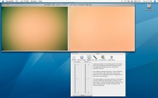
CornerFix v.1.4.2.2
CornerFix for Windows is a small utility program designed to fix the "Cyan corners" problem, caused by color dependent vignetting, with Leica M8 digital cameras using IR filters.

OrthoGraph Survey v.2.0
OrthoGraph Survey is a PDA/phone based professional software for building surveys. It supports floor plan survey by facilitating digital floor plan sketching and instant creation of AutoCAD compatible drawings on-site. It supports Leica Disto D3a/D8.
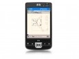
OrthoGraph Architect
OrthoGraph Architect supports floor plan sketching and measurement on-site using a PDA. The measured drawings are shown in real time. Measured rooms or graphical parts are ordered into a structural view. Floating islands, or ghost layers, help users